LEAPSPACE
Making Plant Precision Spraying Your Daily Practice
LeapSpace is a precision Ag platform designed to grow better crops by managing fields with plant precision data.
Growers are facing increasing challenges, from resource scarcity, labor shortages, and unpredictable weather conditions. On top of that, outdated spraying methods and limited technological support increase the risk of application mistakes, leading to wasted inputs and missed crop yields. To stay competitive and sustainable, farmers need smarter, more precise solutions.
LeapSpace is a precision Ag platform designed to help farmers manage their fields at a plant level, optimizing input use while improving crop resilience and yield. By integrating with Farm Management Systems, real-time camera data (LeapEye) and other data providers, LeapSpace enables farmers and agronomists to detect issues earlier and execute variable rate application (VRA) maps and spot spray maps, making plant precision spraying a daily practice.
Why LeapSpace?
✔ Apply What’s Needed, Where It’s Needed
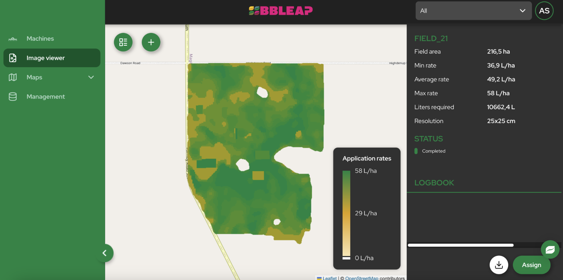
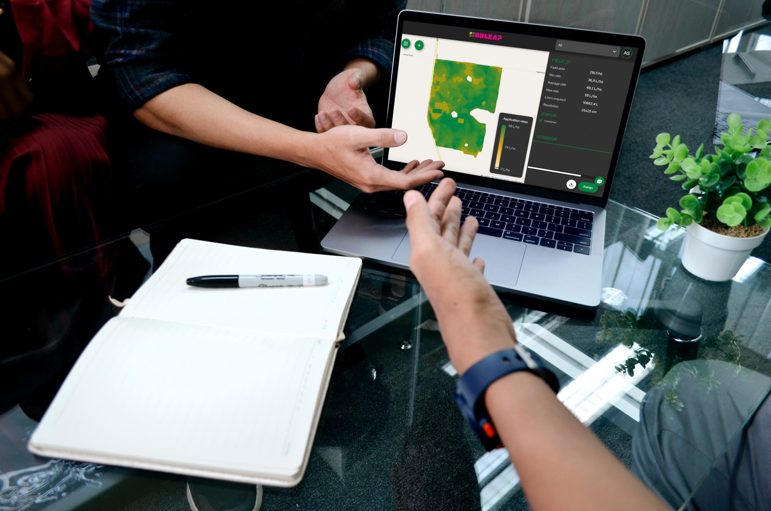
Upload task maps with 25x25cm resolution and control every nozzle individually—saving resources and boosting yields.
✔ Seamless Data Integration
Connect LeapSpace with Farm Management Systems and other data providers to sync field data, spray plans, and performance records.
✔ Scouting & Real-time Crop Insights
Detect issues earlier and get real-time crop insights together with historical spray records.
✔ Stay Compliant & In Control
LeapSpace logs every application—rate, time, location—keeping you audit-ready with confidence.
✔ Wireless Efficiency
Skip the USB sticks. Spray plans are uploaded, synced, and executed via the cloud.
How It Works
1. Upload & Configure
Upload your task maps from satellite, drone, or FMS. Configure per-field settings and assign them to your sprayers.
2. Sync & Execute
LeapSpace syncs wirelessly with LeapBox, ensuring each nozzle sprays exactly the right rate, at the right time.
3. Track & Analyze
As-applied maps, LeapEye images, and spray performance data are saved and accessible any time.
4. Grow & Improve
Use insights to optimize decisions, meet sustainability goals, and manage all spraying at plant level.
Tailored Tools
For Growers and Agronomists
Unlock the full potential of precision farming—whether you’re working in the field or advising from the office.
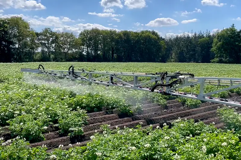
For Growers
Maximize your crop performance
- Reduce risks, improve yields and save resources with VRA and spot spray maps
- Track every application effortlessly with automated documentation and as-applied maps
- Save valuable time with seamless, wireless workflows

For Agronomists
Deliver data-driven advice that makes a difference.
- Help growers reduce risk and increase yield while lowering input use
- Spot issues earlier with advanced crop scouting
- Strengthen crop models and advisory services with high-resolution plant-level data
Features at a Glance
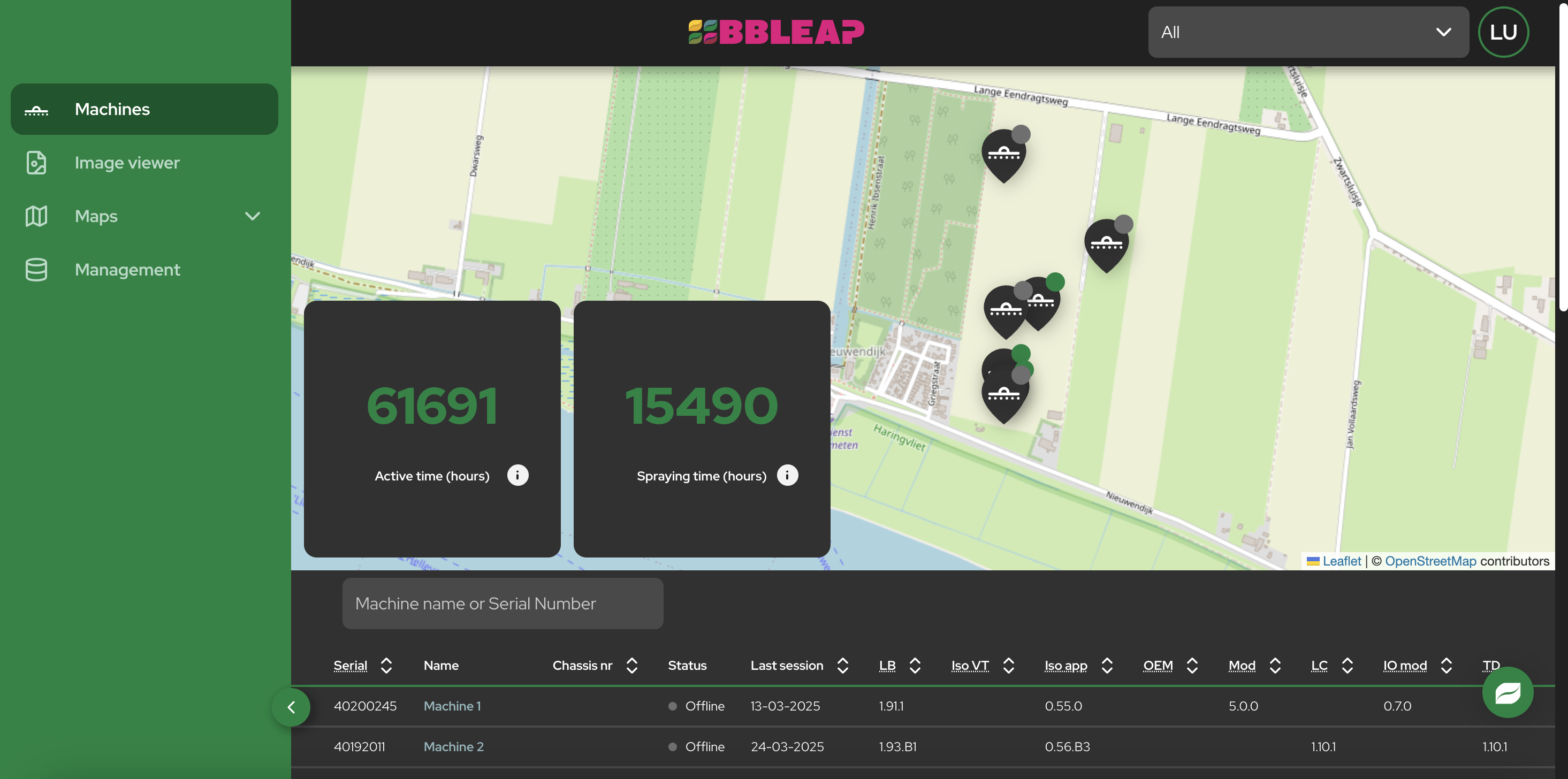
Machine Connectivity
Monitor machine status, location, and performance metrics in real-time.
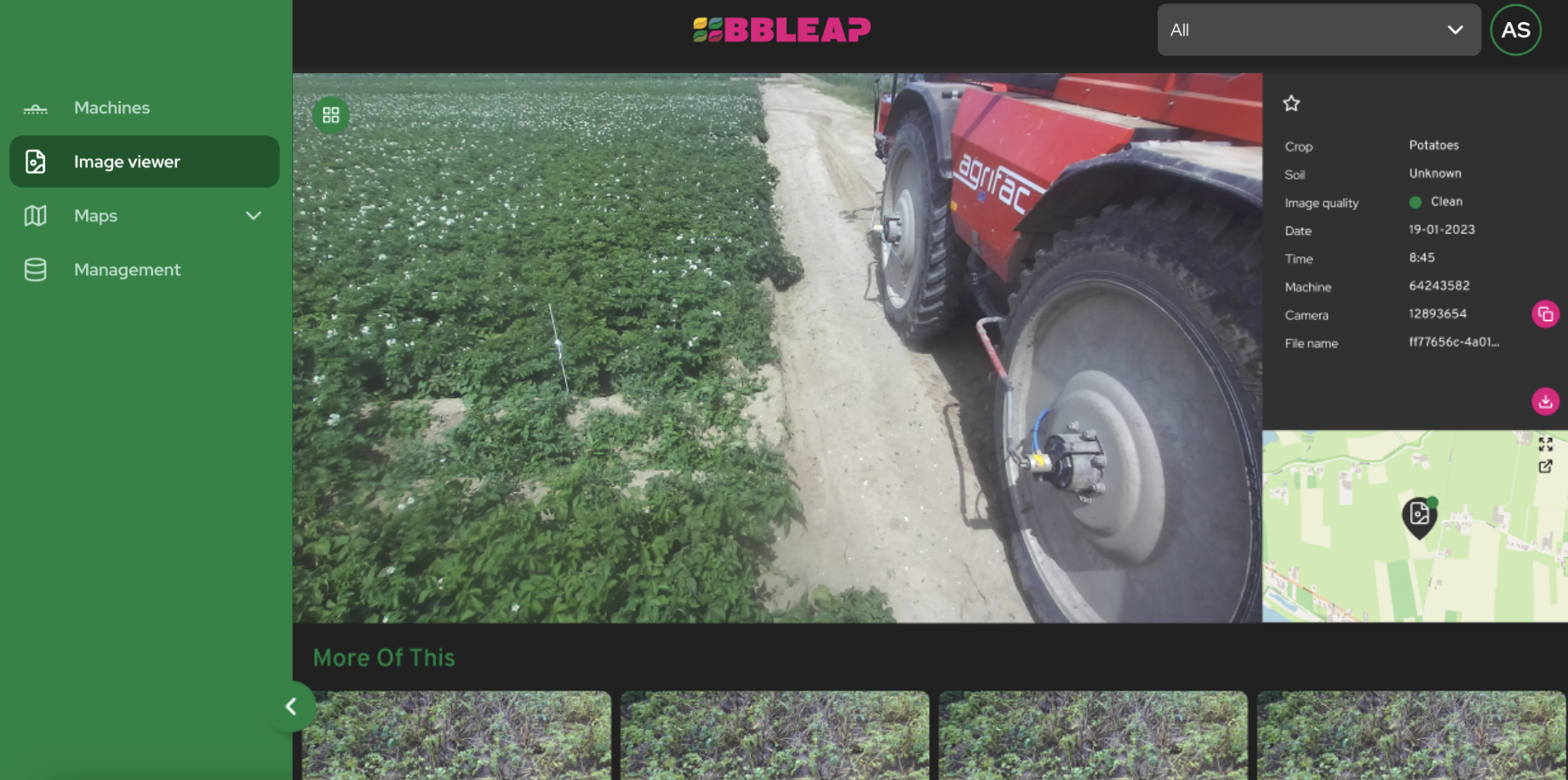
Plant Precision Field Data
Access as-applied maps for all sprayings, view images, and analyze high-resolution NDVI maps from LeapEye cameras (available medio 2025).
High-Resolution Task maps
Upload variable rate application (VRA) maps and spot spray maps, assign them to LeapBox machines, and execute high-resolution task maps with individual nozzle rate control regardless of the type of sprayer and GPS system.
Partner Connections
Seamlessly integrate with leading farm management systems and other data providers to unlock and share plant precision data.
User Management
Invite and work together with your agronomist or co-workers. Securely manage user access and roles.
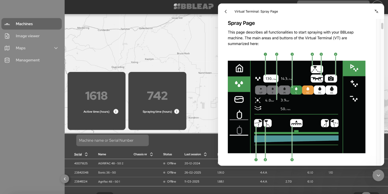
24/7 Knowledge Base & Support
Access comprehensive resources and expert assistance whenever needed.
LeapSpace Works With…
- LeapBox – Executes the spray plans nozzle-by-nozzle
- LeapEye – Adds plant-level imagery & detection data
- Data Providers – Use task maps from satellite, drone and sensors
Join the Leap
LeapSpace helps you grow better crops with fewer inputs.
Turn your sprayer into a precision tool and make plant-level spraying your daily standard.


