Real-time soil sensing to the cloud

Real-time soil sensing connected to the cloud

LeapSoil is a conceptual idea to make real-time soil sensing connected to the cloud. The soil data can be used in the LeapCat as one of the data resources to make prescription maps. The sensor will be mounted on an agricultural machine or tractor with a small working width (higher resolution) and low speed to gather data about soil types and soil nutrients. The data should be stored in the cloud and accessible through LeapCat.

LeapCat is one of the technologies that we are currently developing and expect to launch in 2021.


Configure BBLEAP to your sprayer

Find out all possibilities and functionalities and get a quote.
The Technology Readiness Levels (TRLs)

LeapSoil TRL

BBLeap values open and transparent communication. This includes the stages of our technologies under development. To communicate our progress we use Technology Readiness Levels (TRLs). TRLs are developed and introduced by NASA in order to be consistent and uniform about communicating technology maturity. LeapSoil is identified to be currently in TRL 2. TRL 2 is described as “Technology concept and application formulated”.

Learn more about BBLeap technologies and select one of the developments listed below.

Start Farming On Plant Level

Explore all the options LeapBox opens up. Apply precision farming, spot spraying and / or variable spraying.
Soil humus levels

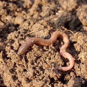
Use field maps that indicate the levels of humus to adjust nutrition and minerals.
Spray on top row crops

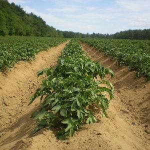
Pre-set different a/b lines to spray against pests or funghes on the row crop only.
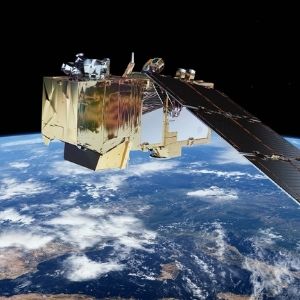
Use satellite data

Satellite data is freely available and is a good way to start.

Start Farming On Plant Level

Explore all the options LeapBox opens up. Apply precision farming, spot spraying and / or variable spraying.

Soil humus levels

Use field maps that indicate the levels of humus to adjust nutrition and minerals.

Spray on top row crops

Pre-set different a/b lines to spray against pests or funghes on the row crop only.

Use satellite data

Satellite data is freely available and is a good way to start.

LeapBox
LeapCat trl
LeapJet Logo
LeapCrest trl
LeapSoil TRL
LeapPlus trl

Frequently asked questions:

  • What is the concept behind BBLeap's LeapSoil?
    LeapSoil is a conceptual idea from BBLeap that connects real-time soil sensing to the cloud. This system is designed to gather detailed information about soil types and nutrients. The sensor will be mounted on an agricultural machine or tractor, operating with a small working width and low speed to ensure high-resolution data collection. The collected soil data is then stored in the cloud and becomes accessible through LeapCat, one of our technologies currently under development. This data can be utilized within LeapCat as a crucial resource for generating precise prescription maps, thereby contributing to optimized precision farming practices and more informed decision-making for growers.
  • How does BBLeap communicate the development status of LeapSoil?
    BBLeap prioritizes open and transparent communication regarding the progress of our technologies. To achieve this, we utilize Technology Readiness Levels (TRLs), a standardized system originally developed by NASA to consistently communicate technology maturity. Currently, LeapSoil is identified as being at TRL 2. This level is defined as “Technology concept and application formulated,” meaning that the basic concept and potential applications of LeapSoil have been established and are being further elaborated. This approach enables us to clearly communicate the developmental stage of LeapSoil and our other innovations to all stakeholders, fostering trust and understanding.
  • How does LeapSoil integrate into the broader BBLeap precision agriculture ecosystem?
    LeapSoil is a conceptual component of BBLeap's broader ecosystem, which is dedicated to 'Farming On Plant Level'. The real-time soil data collected by LeapSoil is intended to serve as a critical information source for LeapCat, one of our developing technologies designed for creating detailed prescription maps. By accurately mapping soil types and nutrients, LeapSoil aims to empower growers to make even more precise decisions regarding crop care. This integrates seamlessly with other BBLeap products, such as LeapBox, which enables the execution of these task maps at the plant level, ultimately leading to optimized and sustainable agricultural practices and improved resource management.
  • What are the benefits of using real-time soil data for agricultural applications?
    Using real-time soil data offers significant benefits for farmers, enhancing their cultivation practices. By collecting current information on soil types and nutrients, agriculturalists can align their fertilization and irrigation strategies more precisely with the specific needs of each plot. This leads to a more efficient use of resources, preventing over-fertilization and reducing environmental impact. Furthermore, a deeper understanding of soil conditions contributes to healthier crops, higher yields, and more sustainable farm management, which is essential for modern precision agriculture and achieving both economic and ecological advantages. This data supports proactive and informed decision-making.
  • How can precision agriculture technology improve the efficiency and sustainability of a farm?
    Precision agriculture technology significantly enhances both the efficiency and sustainability of an agricultural operation. By applying resources such as water, fertilizers, and crop protection agents only where and when necessary, waste is minimized. This reduces operational costs and increases profitability. Concurrently, it lowers the environmental footprint of farming by introducing fewer chemical agents into the environment and counteracting soil depletion. The result is more efficient cultivation, higher-quality yields, and a fundamentally more sustainable approach to food production. This smart application of resources directly supports both economic viability and ecological responsibility, aligning with modern agricultural demands.